Guidebook with maps/step-by-step
The route starts near the Café du Centre in Vaulnaveys-le-Haut, on the Chemin des Chartreux.
Gradually, as you gain altitude, you discover the numerous meadows on a terrace: the Plan Rinjat at 550m altitude, from which the view is already very clear. The path climbs up and skims the Chamrousse road at the Montgardier and Fujarey hairpin bends.
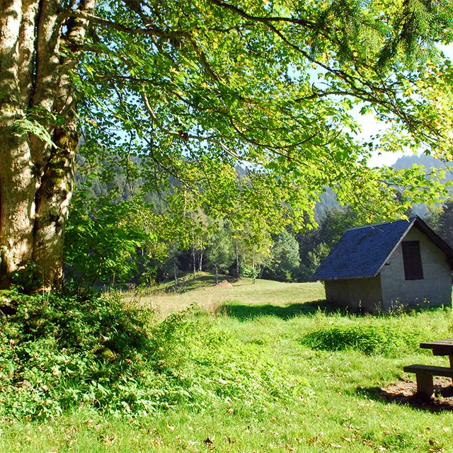
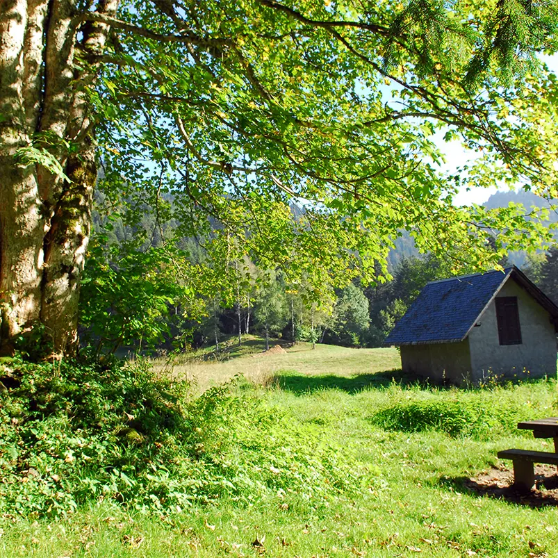
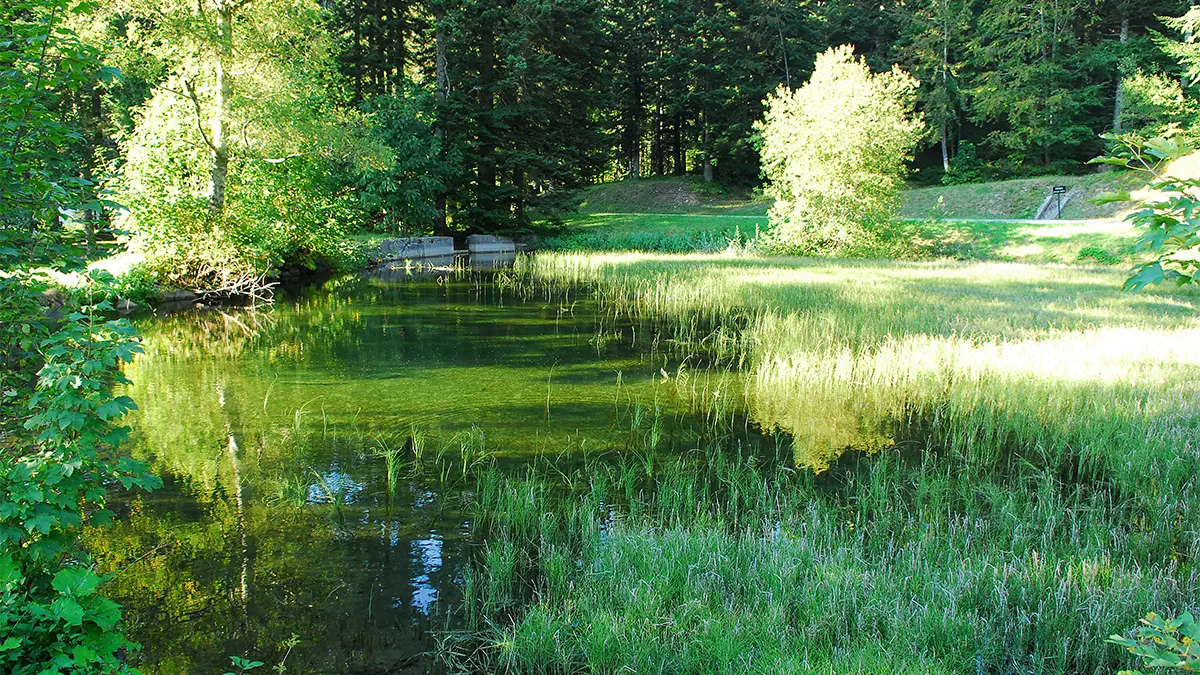
The route then turns south and becomes forested. Beech and spruce trees are omnipresent. Continue the forest ascent to Prémol, at 1080m, passing by the remains of the ancient Chartreuse. Cross the Chamrousse road once, then a second time to stay below it until you reach Lac du Luitel at 1250m, the end of the ascent.
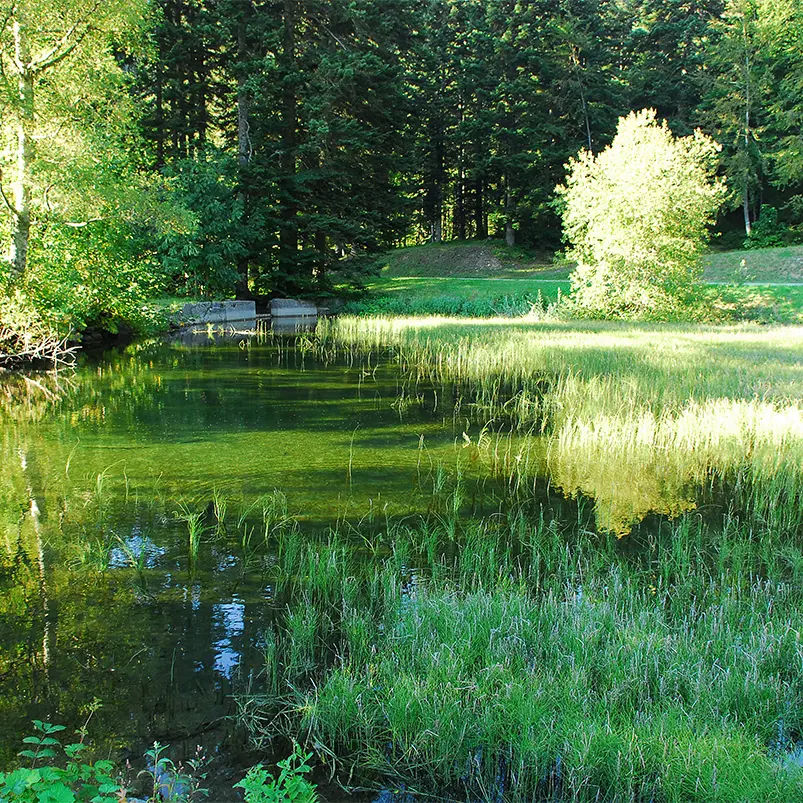
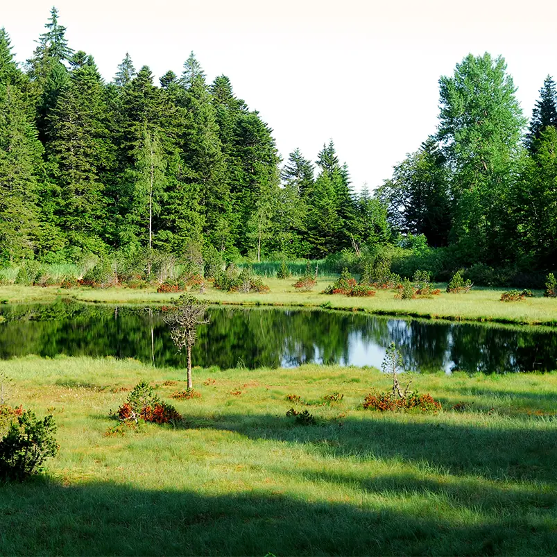
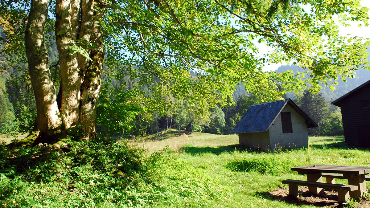
Arriving near the nature reserve chalet, you can enjoy a picnic on the tables, or learn more about the peat bogs and discover sphagnum moss, carnivorous plants, hooked pines, dragonflies and many other natural curiosities.
Starting out on the discovery trail on duckboards, you'll be able to observe this complex and fragile ecosystem.
The descent takes place on a wide, comfortable trail, with excellent views of the Vercors, Chartreuse and Grenoble. Further down, hikers will pass through the charming hamlet of "Montchaffrey" and then reach the hamlet of "Les Roberts".
Descend to Les Alloues. The descent takes you through meadows and forest, before joining a small road at "Les Meynards".
At the "Les Meynards" signpost, turn right and return to the starting point via a small road: "promenade de la mondée", then the "route des pénitents blancs" and finally the "chemin de prè l'abé".
Tour stages:
Les Meynards / Vaulnaveys-le-Haut / Le Bourg / La Gorge / Montgardier / Fujarey / Réservoir / Chartreuse de Prémol / Balise / L'Exutoire / Maison de la Réserve / Lac Luitel / L'Exutoire / Le Moulin / Fontaine du mulet / Montchaffrey / Les Roberts / Bessera and la Ripa : Les Meynards
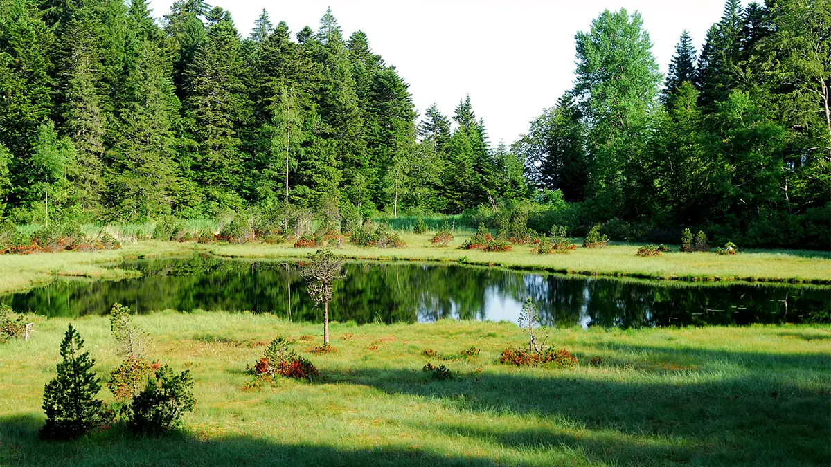
THE LUITEL NATURE RESERVE
The Lac Luitel Nature Reserve, the oldest of France's nature reserves, occupies a depression created by the Romanche glacier at an altitude of 1250 m along the access road to the Chamrousse ski resort. It comprises two peat systems: the lake peat bog, characterized by floating rafts, and the Col peat bog, partially forested by hooked pines. All stages of the ecological evolution of these sphagnum moss environments can be found here. This northern landscape is a haven for relict species from the ice ages. The site is managed by the ONF, which is responsible for a number of tasks, including public access, site development, scientific studies and monitoring.