Start : Les Seiglières (1065 m) - 2 h (4.6 km, D+ 458 m, D- 63 m)
From the stop, cross the road to reach the parking lot, start on the marked path (direction east) towards the Cascade de l'Oursière.
The itinerary goes through the forest, goes down to reach the Etang des Marais Chauds and then the crossing of Marais Chaud. Then take the path going up south-east. At Pierre Molle, take the Gâtte road on the left and then the bridge over the Pourrettes stream. The path crosses always in forest, intersects 2 scree slopes and their brooks, until reaching the waterfall of Oursière.
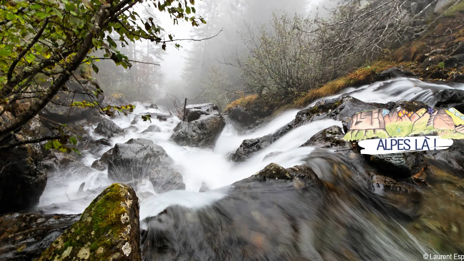
1) Cascade de l'Oursière (1472 m) - 1 h 25 (1.9 km, D+ 457 m)
Go up in the forest by well traced but rather steep laces until you reach a flat area where you discover the different meanders of the Doménons stream. At the Oursière, choose the path towards the Robert Lakes, which then moves away from the river bed. Go up the slope lined with shrubs (alders) until you reach a new flat to the south where you meet the GR738®.
2) (under) Le Grand Sorbier (1928m) - 20 min (0.8 km, D+ 88 m, D- 14 m)
Continue in the valley south on the GR738® trail and discover the first Roberts lakes.
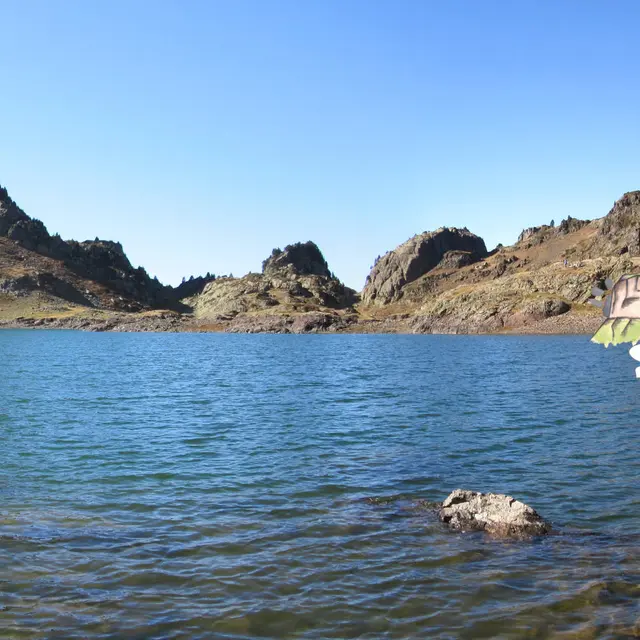
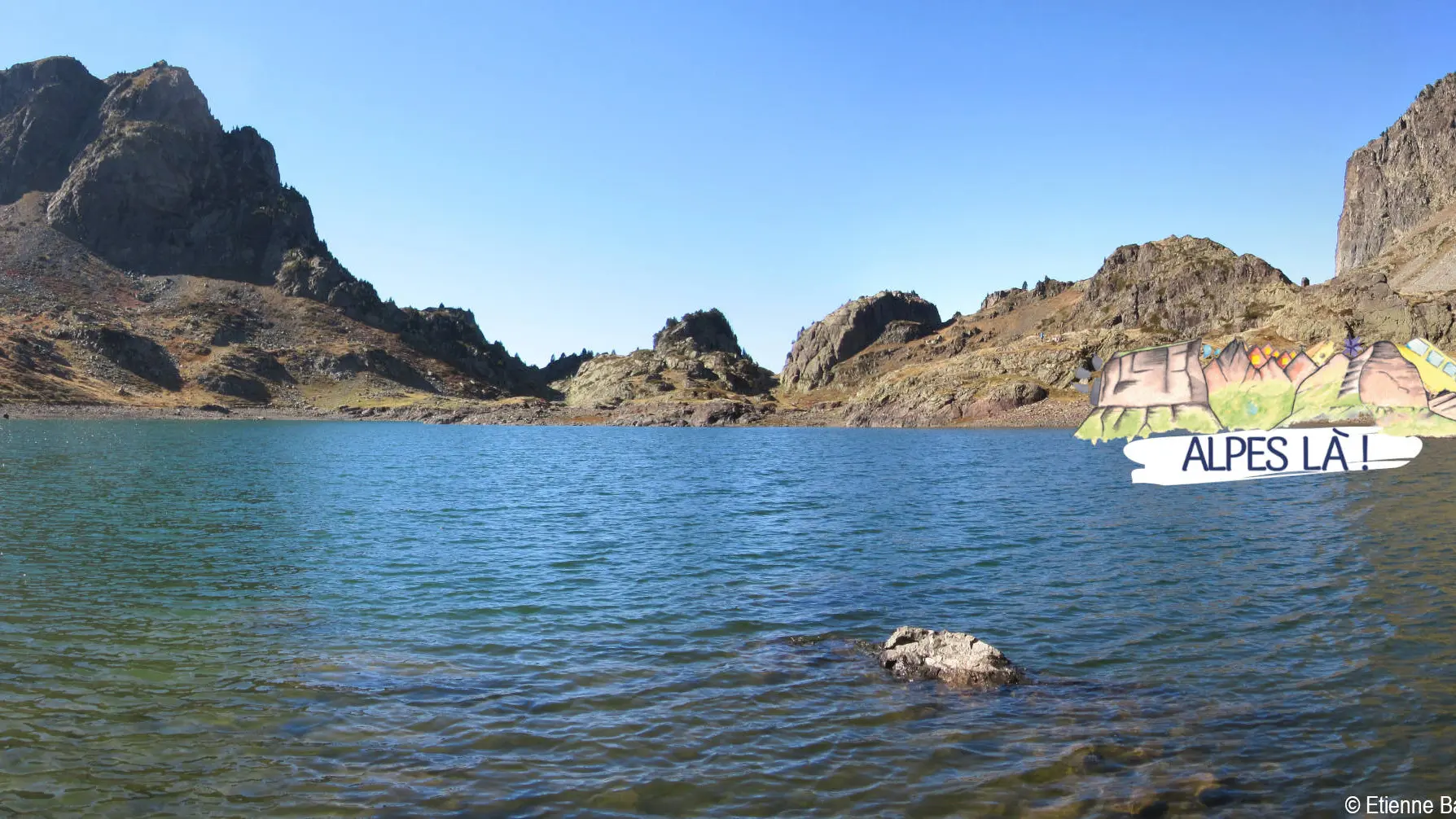
3) Robert Lakes - Brèche Robert Nord (2050m) - 45 min (1.9 km, D+ 48 m, D- 295 m)
Continue on the GR® by the north of the lake to reach the Brèche Robert Nord, then go down in the combe to the Lac des Pourettes. 500 m after the lake, we reach the crossroads La Grande Aiguille (itinerary variation towards Casserousse possible from this point).
4) (under) La Grande Aiguille (1762m) - 45 min (2.1 km, D+ 78 m, D- 167 m)
Always go down by the GR738® to join the slopes of the Chamrousse resort and the Recoin snow front at the Aiguille ski lift.
Back to the resort: Chamrousse 1650 (Le Recoin)
A hike possible without a car where you can take the bus to and from. Make sure you know the time and day of traffic before you leave.
Read more